
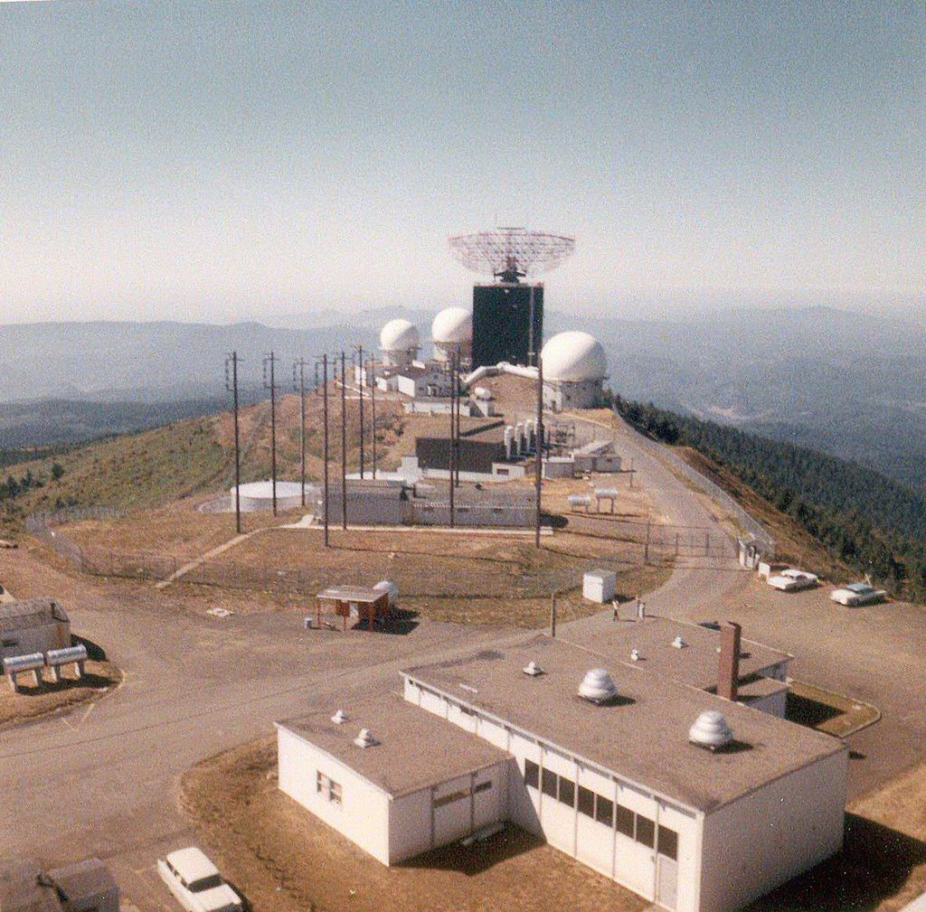
Today, few traces remain of Mt. Hebo’s days as a Cold War-era U.S. military station.
However, from 1956 until 1980, Mt. Hebo was home to a U.S. Air Force General Surveillance Radar Station, a long-range radar installation, with 4,000 people serving there over the years. The purpose of the station, which worked in conjunction with McChord Air Force Base in Washington, D.C., was to prevent the USSR from attacking the region by air.
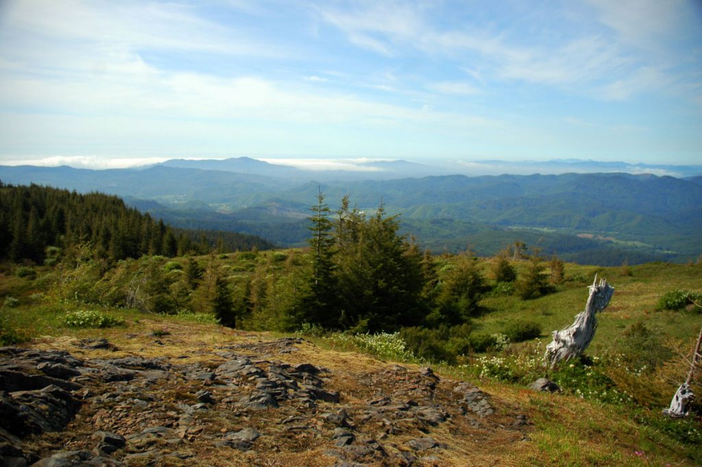
These days, as part of the Siuslaw National Forest, the 3,100-foot-tall mountain is better known for its camping, hiking, horseback-riding and fishing opportunities, not to mention its views. None of the Air Force buildings remain.
Part of the Coast Range, Mt. Hebo straddles the Tillamook and Yamhill County lines and offers 360-degree vistas from its summit, which is accessed by an 8-mile forest service road from the community of Hebo. The U.S. Forest Service, which occupies offices at the base of the mountain, manages the area.

The hike from Hebo Lake to the summit runs about 9 miles with an elevation gain of roughly 1,500 feet. Experienced hikers rate the difficulty as moderate. A shorter, easier hike loops about half-a-mile around Hebo Lake. If you’re quiet and observant, you might encounter an Oregon silverspot butterfly, a sensitive species that lives in the mountain’s meadows.
There are 12 campsites, open from late March through Nov. 1, surrounding the 3-acre Hebo Lake, which is equipped with five fishing docks and stocked with rainbow trout. Watch Travel Oregon’s “Grant’s Getaways” for great views of the campground. (The Hebo Lake Campground footage is about halfway through the video.)
While you’re in Hebo, be sure to visit its fellow unincorporated communities, Beaver and Cloverdale for an unvarnished Tillamook Coast experience.