Tillamook County Trails and Recreation Map
From detailed trail information to campsites to picnic areas, this mapping tool will help you plan your next outing to our part of Oregon's north coast.
How to Use the Map
To browse locations, you can either use the list in the left column, which is sorted by type of destination. Or collapse that menu and use the zoom tools to browse in the map interface. (Note that locations in the left-hand menu only reflect those that are within the zoom boundaries.) You can also use the search field in the upper-right corner to find a specific location or activity. Each location launches a pop-up featuring expanded information, including amenities, fees, services, and often, photos. In the green navigation bar at the top, you’ll find options for helping you filter or show/hide locations, along with a legend, and sharing and printing options.
 Alerts
- Stagecoach Horse Camp will be closed starting July 12th, 2021. The closure will remain in effect until operations are complete. Signs will be posted on the campground entrance boards throughout the closure.
- Jordan Creek Road will be closed at the ¼ mile mark starting July 15th, 2021. The closure includes all dispersed campsites and Jordan Creek OHV Campground and OHV trails. In addition, portions of Archers Road, Portland Mills, and Phipps Creek Roads will be closed at points of access to Jordan Creek Road.
- Tillamook Forest Center is open Wednesday-Sunday 10am-4pm.
- Cape Meares Lighthouse tours do not include the lens housing area at this time.
 Georeferenced PDFs
These files can be opened in Avenza and other apps to navigate offline. Here are a couple files to get you started. You can make more using the Print button in the map explorer above.
 Public transportation to the coast, mobility aids, restrooms
 Marine Reserves
Map Feedback
Do you see an error on the map or notice a safety issue at a location? Please let us know.
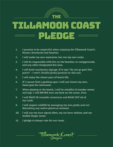
Take the Tillamook Coast Pledge and help us care for our coast.